Lipulekh Pass: History, Tourism Potential, and the Kailash Mansarovar Route via Nepal
 Kedar Neupane
30th Aug, 2025
Kedar Neupane
30th Aug, 2025
Kedar Neupane
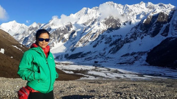
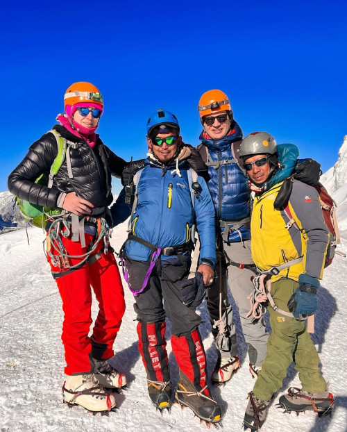
I am Kedar Neupane, a passionate traveler, entrepreneur, mentor, and social contributor, born and raised in a village near the Nepal-China border in Sindhupalchok, Nepal. With a Master’s degree in Business from Tribhuvan University and Level 2 proficiency in the German language, I have dedicated my life to tourism, trade, mentorship, and holistic well-being.
🌍 A Global Explorer with a Vision
Having explored 26+ countries, I have gained profound insights into diverse cultures, business landscapes, and global tourism. My travels have taken me to:
🇹🇭 Thailand | 🇧🇹 Bhutan | 🇲🇾 Malaysia | 🇸🇬 Singapore | 🇨🇳 China | 🇭🇰 Hong Kong | 🇩🇪 Germany | 🇵🇱 Poland | 🇦🇹 Austria | 🇨🇭 Switzerland | 🇭🇺 Hungary | 🇳🇱 Netherlands | 🇧🇪 Belgium | 🇫🇷 France | 🇦🇪 UAE | 🇬🇧 UK | 🇺🇸 USA | 🇹🇷 Turkey | 🇶🇦 Qatar | 🇮🇳 India | 🇮🇩 Indonesia | 🇨🇦 Canada
Through my journeys, I have developed a deep appreciation for cultural exchange, adventure tourism, and sustainable business practices.
🏔️ Entrepreneurial & Professional Journey
I am actively involved in tourism, trade, and mentorship, leading multiple ventures that promote sustainable travel, adventure tourism, and business development:
✔ Founder & MD – Actual Adventure Pvt. Ltd. (A leading adventure travel company in Nepal)
✔ CEO – Himalayas Destination Management Company (Creating premium travel experiences)
✔ MD – Nepal Export & Import Pvt. Ltd. (Promoting Nepalese products globally)
✔ MD – Actual Mentor Pvt. Ltd. (Empowering entrepreneurs and professionals)
✔ Chairman – World Expedition Nepal (Focusing on high-altitude expeditions and trekking)
Through my entrepreneurial journey, social contributions, global explorations, and commitment to lifelong learning, I strive to inspire others to pursue their passions while making a meaningful difference. My dream is to build a world where travel, business, and holistic well-being come together, fostering growth, sustainability, and happiness for all.
Introduction
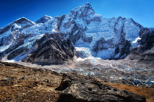
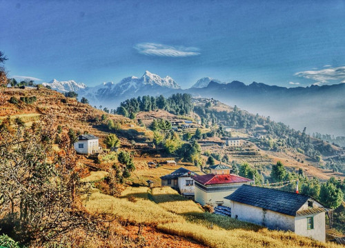
Lipulekh Pass (5,334 m) is one of the oldest Himalayan gateways between South Asia and Tibet, lying in the far-western region of Nepal (Darchula District) at the tri-junction of Nepal, India, and Tibet (China). For centuries, this high-altitude corridor has been used by traders, pilgrims, and local Himalayan communities.
Table of Contents
Today, Lipulekh has become a subject of geopolitical debate, as well as an opportunity for tourism and spiritual travel. From the sacred Kailash Mansarovar Yatra to trekking and cultural exploration, Lipulekh represents both heritage and future potential.
Historical Background: Lipulekh as Nepal’s Land for Over a Century
The history of Lipulekh is closely tied to Nepal’s sovereignty and territorial boundaries:
-
1816 Sugauli Treaty: Signed between the East India Company and the Kingdom of Nepal, this treaty recognized the Kali River as the western boundary of Nepal. All land east of the Kali River, including Lipulekh, Kalapani, and Limpiyadhura, belongs to Nepal.
-
100 years ago and earlier: Local Byansi, Chaudhari, and Rung communities freely used Lipulekh as a trade route. Nepalese traders carried grains, ghee, and spices to Tibet, while returning with salt, wool, and Tibetan goods.
-
British-era maps and records: Several official maps from the late 19th and early 20th centuries show Lipulekh and the region east of Kali River as part of Nepal.
-
Recent disputes: Agreements between India and China in the 1950s and 2015 regarding the use of Lipulekh for trade and pilgrimage were signed without Nepal’s consent. Nepal officially objected, stating that the land is its sovereign territory.
Thus, historically and culturally, Lipulekh has been Nepalese land for more than a century, and its importance continues today.
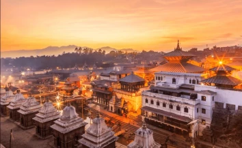
Lipulekh and the Kailash Mansarovar Yatra
Significance of Kailash Mansarovar
Mount Kailash and Lake Mansarovar in Tibet hold deep spiritual meaning for Hindus, Buddhists, Jains, and Bonpos:
-
Hindus regard Mount Kailash as the abode of Lord Shiva.
-
Buddhists associate it with the mystical Mount Meru, the center of the universe.
-
Jains believe their first Tirthankara, Rishabhdev, attained liberation here.
-
Bon religion followers consider it their most sacred mountain.
Lipulekh as a Route to Kailash
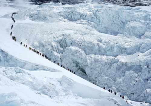
-
Lipulekh provides one of the shortest routes to Kailash Mansarovar from South Asia.
-
Pilgrims crossing Lipulekh enter Taklakot (Burang County, Tibet) and then proceed to Darchen, the base town for circumambulating Mount Kailash.
-
Traditionally, this route was used by Nepalese and Indian pilgrims for centuries before modern borders.
For Nepal, developing the Darchula–Gunji–Lipulekh–Taklakot trail as a Nepal-led Kailash Yatra route would boost its religious tourism industry.
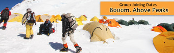
Tourism Potential of Lipulekh
Lipulekh is not only a religious passage—it can also be developed as a multi-dimensional tourism destination.
1. Adventure and Trekking Tourism
-
Trekkers can explore the Api-Nampa Conservation Area, home to snow leopards, Himalayan thar, and rare medicinal plants.
-
The Lipulekh trek passes through remote Byansi villages, offering cultural immersion.
-
Treks can combine Lipulekh with Kalapani, Gunji, Chaulikhar, and Limpiyadhura, creating a rich heritage circuit.
2. Cultural Tourism
-
The Byansi/Rung communities preserve distinct traditions, dialects, and rituals influenced by both Hindu and Tibetan Buddhism.
-
Local homestays can offer experiences of folk dances, traditional attire, Himalayan cuisine, and cultural festivals.
3. Religious Tourism
-
Developing Nepal’s official route for Kailash Mansarovar Yatra via Lipulekh can attract thousands of pilgrims each year.
-
Nepal can benefit economically through permit fees, guiding services, porters, and accommodation.
4. Eco-Tourism
-
The region is rich in biodiversity—Himalayan herbs, yarsagumba (cordyceps), alpine flowers, and forests.
-
Eco-trekking packages can help conserve the fragile mountain ecosystem while creating jobs.
Challenges in Promoting Lipulekh Tourism
-
Territorial Disputes – Nepal’s rightful claim has been ignored in bilateral agreements between India and China.
-
Infrastructure Gap – Roads and health facilities on Nepal’s side are underdeveloped compared to Indian routes.
-
High-Altitude Risks – Pilgrims and trekkers need better rescue and medical services.
-
Environmental Fragility – Tourism could damage sensitive alpine zones if not managed responsibly.
Suggestions for Sustainable Development
-
Promote Nepal’s Own Kailash Route
-
Establish official Nepal–China border crossing permits for pilgrims via Lipulekh.
-
Coordinate with Chinese authorities for a direct Nepalese Kailash Yatra route.
-
-
Invest in Road and Trekking Infrastructure
-
Improve the road from Darchula to Gunji and Chaulikhar.
-
Build eco-lodges, health posts, and communication networks.
-
-
Eco-Friendly Tourism Policy
-
Limit the number of visitors per season.
-
Implement strict waste management rules to preserve the Himalayas.
-
-
Local Empowerment
-
Train local youth as guides, porters, and homestay operators.
-
Promote handicrafts, woolen products, and organic Himalayan herbs.
-
-
Trilateral Tourism Cooperation
-
Nepal, India, and China can collaborate on border tourism packages, but only if Nepal’s sovereignty is respected.
-
Lipulekh could be marketed as a “Gateway of Friendship and Pilgrimage” in the Himalayas.
-
Kailash — Route Distances & Practical Details
Quick reference tables for major approaches: Lipulekh, Nathula, Uttarakhand roads, Pithoragarh new alignments, Nepal (Simikot–Hilsa) and Delhi start points.
Lipulekh Pass → Kailash Mansarovar
| Segment | Typical Route / Stops | Approx. Distance | Mode | Notes |
|---|---|---|---|---|
| Start → Lipulekh | Dharchula (India) or Darchula (Nepal) → Gunji → Nabhidang → Lipulekh | ~70–100 km (road + trek stages) | Jeep / trek | Roads to Gunji exist; final approach often involves short high-altitude trekking. Recent road upgrades have shortened trekking in places. |
| Lipulekh → Taklakot (Burang) | Border crossing → Taklakot town (Purang) | ~18–20 km | Walk / vehicle (permit dependent) | Short high pass crossing; permits and border formalities required. |
| Taklakot → Mansarovar → Darchen | Taklakot → Mansarovar Lake → Darchen (Kailash base) | ~80–95 km (by road) | Bus / coach | Plateau roads — long but mostly motorable; local driving conditions vary. |
| Total (typical) | ~170–220 km (mix of road, short trekking & plateau driving) | Traditional shortest land route from NW India; popular for pilgrims from Uttarakhand/Nepal. | ||
View & route references: modern Lipulekh itineraries and trip notes report a total multi-stage distance often estimated around 200–250 km depending on starting point and actual road access. :contentReference[oaicite:1]{index=1}
Nathula Pass (Sikkim) → Kailash Mansarovar
| Segment | Typical Route | Approx. Distance | Mode | Notes |
|---|---|---|---|---|
| Gangtok → Nathula | Gangtok → Nathu La (via Tsomgo / Changu Lake) | ~50–60 km | Road / bus | High-altitude border pass; permits and seasonal opening apply. |
| Nathula → Lhasa → Mansarovar | Nathu La → Yadong → Lhasa → Shigatse → Saga → Mansarovar | ~1,200–1,600 km (road across Tibet depending on route) | Coach / bus | Longer overall road distance on the Tibetan plateau but less trekking. Often chosen for comfort and senior pilgrims. |
| Total (typical) | ~1,200–1,600 km (mostly road) | Route gives chance to visit Lhasa and Tibetan monasteries en route. :contentReference[oaicite:2]{index=2} | ||
Nathula option is more road-driven; overall distance is higher but with far less high-altitude trekking than Lipulekh. :contentReference[oaicite:3]{index=3}
Uttarakhand → Kailash Mansarovar (Road + Lipulekh)
| From | Key Stages | Approx. Distance | Mode | Notes |
|---|---|---|---|---|
| Delhi → Dharchula | Delhi → Almora / Haldwani → Pithoragarh → Dharchula | ~500–750 km (depending on routing) | Road (car/bus) | Typical travel time 1–2 days by road; many groups use trains/planes partway. |
| Dharchula → Lipulekh → Mansarovar | Dharchula → Gunji → Nabhidang → Lipulekh → Taklakot → Mansarovar | ~200–300 km (mix of road & trek & plateau drive) | Jeep / trek / bus | New road upgrades have shortened overland times to the border in recent years. |
| Total Delhi → Mansarovar (typical) | ~700–1,000+ km (combined road & high plateau driving) | Estimates vary by chosen entry point (Lipulekh vs Nathula vs Nepal route). :contentReference[oaicite:4]{index=4} | ||
Road distances from Uttarakhand are heavily dependent on final road access to Lipulekh and whether pilgrims use domestic flights to shorten the approach. :contentReference[oaicite:5]{index=5}
Pithoragarh → (New / Improved) Lipulekh Alignments
| Segment | Route | Approx. Distance | Mode | Notes |
|---|---|---|---|---|
| Pithoragarh → Gunji / Dharchula | Pithoragarh → Dharchula → Gunji | ~150–220 km (road) | Road (taxi / bus) | Newer roads reduce travel times from Pithoragarh and make Lipulekh approachable in fewer days. :contentReference[oaicite:6]{index=6} |
| Gunji → Lipulekh | Gunji → Nabhidang → Lipulekh (short trek/road mixes) | ~30–40 km (final high approach) | Jeep / trek | Portion still high-altitude terrain; acclimatisation recommended. |
Local reports and pilgrimage operators confirm road upgrades on the Pithoragarh–Gunji corridor, improving accessibility. :contentReference[oaicite:7]{index=7}
Nepal Route — Simikot → Hilsa → Taklakot (Purang)
| Segment | Route / Stops | Approx. Distance | Mode | Notes |
|---|---|---|---|---|
| Kathmandu → Nepalgunj → Simikot | Flight Kathmandu → Nepalgunj → Simikot (air transfer common) | Flight legs; Simikot airstrip ~1 hr from Nepalgunj | Flight | Most yatris fly into Simikot (seasonal), then continue to Hilsa. |
| Simikot → Hilsa (Nepal side) | Short helicopter/overland or trek to Hilsa (border) | ~40–60 km (depending on helicopter/ground movement) | Helicopter / trek | Heli options are popular; ground approach is longer and remote. :contentReference[oaicite:8]{index=8} |
| Hilsa → Taklakot → Mansarovar | Hilsa (Nepal border) → Purang/Taklakot (Tibet) → Mansarovar | ~30–100 km (short border cross + plateau driving; commonly ~80–120 km to Mansarovar) | Vehicle / coach | Shortest international route from Nepal; widely used by organized groups. :contentReference[oaicite:9]{index=9} |
The Nepal (Simikot–Hilsa) option is popular because it reduces overland time and heavy trekking; helicopter links are common in peak season. :contentReference[oaicite:10]{index=10}
Delhi → Kailash Mansarovar (Overview)
| Option | Main Stages | Approx. Distance | Mode | Typical Notes |
|---|---|---|---|---|
| Via Lipulekh (Uttarakhand) | Delhi → Dharchula → Lipulekh → Mansarovar | ~700–900+ km (combined) | Road / trek / plateau bus | Shortest total land route from Delhi when Lipulekh is used; road upgrades changing timings. :contentReference[oaicite:11]{index=11} |
| Via Nathula (Sikkim) | Delhi → Bagdogra → Gangtok → Nathula → Lhasa → Mansarovar | ~1,200–1,800+ km (flight + long road) | Flight + road | Longer but more road-based and comfortable for non-trekkers. :contentReference[oaicite:12]{index=12} |
| Via Nepal (Simikot) | Delhi → Kathmandu/Nepalgunj → Simikot → Hilsa → Mansarovar | ~1,000–1,400 km (mix — depends on flights chosen) | Flight + helicopter/road | Often time-efficient for international pilgrims if flown from Kathmandu/Nepalgunj. :contentReference[oaicite:13]{index=13} |
Distances vary widely depending on where you start in India, whether you use flights, and which border crossing is open/selected. Check permits, seasonal openings, and operator routes before booking.
Conclusion
Lipulekh is a symbol of history, culture, and spirituality. For over 100 years, it has been Nepalese land, connecting the Himalayan communities of Darchula with Tibet. Beyond the border disputes, Lipulekh holds the potential to become an international hub for adventure trekking, cultural exchange, and religious pilgrimage—especially for the Kailash Mansarovar Yatra.
By preserving its fragile ecology, respecting local traditions, and asserting its sovereign rights, Nepal can transform Lipulekh into a model of sustainable mountain tourism. In doing so, Lipulekh will not only remain a historic pass but also a gateway of unity, faith, and Himalayan discovery.
Recent Posts


8th Feb, 2026

6th Feb, 2026